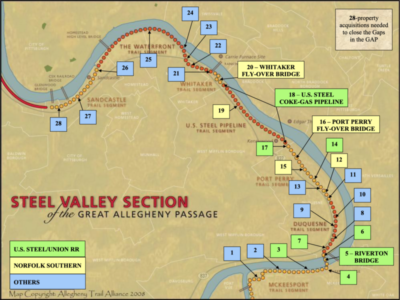
Whitaker Bridge – Mon-River
On a foggy early July morning in 2010, dozens of people stood along the banks of the Monongahela River outside Pittsburgh waiting to witness a feat of engineering and determination. Two cranes, almost 2-miles apart, were about to lift two bridges into place simultaneously, providing a means for walkers, runners and bicyclists to pass over active railroad lines.
Between the bridges, on an adjacent wooded hillside, lie a narrow 1.9-mile corridor once used to service U.S. Steel’s coke-gas pipelines–an ideal location for a trail. Like the steel roller coaster in the amusement park above and the busy railroad tracks below, the two 48-inch diameter coke-gas pipes were built within the Mon-Valley,[1] a region famous for the coal and steel economy that once made this corner of the world an industrial powerhouse—the home of soot, metal, sweat, and money.
On that July morning, the now-remediated corridor that once carried the retired pipelines represented a different kind of progress, driven by people with a different perspective on use of the land: The bridges and the pipeline segments, critical links in an effort complete the last nine miles of the Great Allegheny Passage (GAP), would bring trail builders closer to the goal of a non-motorized, off-road connection between the Nation’s capital and the City of Steel. Success, however, was never guaranteed.
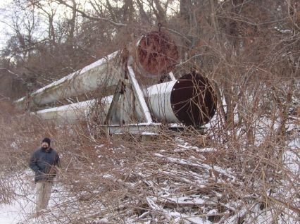
Coke-gas pipeline, United State Steel-Union Railroad.
Steel Legacy
Linda McKenna Boxx, volunteer President and CEO of the Allegheny Trail Alliance (ATA),[2] understood that the last nine miles would be extremely difficult.
After completing the challenging $12 million Big Savage Tunnel rehabilitation project in Somerset County, Pennsylvania, which made the connection with Allegheny County, Maryland, and passage through the mountains possible, Boxx set her sights on eliminating the remaining gaps in the GAP—the nine miles that could provide a means to walk and bicycle between Washington, D.C. and Pittsburgh’s Golden Triangle.
She had her work cut out for her. “There was no route; there was no corridor … nine-ish miles, and—except for the coke-gas pipeline—there was no other piece of real estate that we could build trail on.”[3] Not to say that Boxx wasn’t confident she could get it done; if anything, she was one of those most equipped to help make the trail happen. “She [Boxx] just simply does not take ‘no’ for an answer,” said Hannah Hardy, a fellow trail-builder who in 2003 left employment of the City to continue trail work through the Pennsylvania Environmental Council (PEC)[4] and later joined Boxx on the ATA and Regional Trail Corporation (RTC) boards of directors.[5]
Boxx’s confidence came from experience: “RTC built trails on brownfields,” Boxx said. “We know how to build them and we know how to protect our users [pedestrians and riders][6]… We weren’t scared off by potential liabilities.”[7] It was a strength that would prove invaluable as ATA and RTC attempted to eliminate trail gaps in the Steel Valley near Pittsburgh—a conglomeration of old steel mills, working class communities, and a struggling post-industrial economy along the bends of the Monongahela River (“the Mon”).
In this corridor, trail builders’ history walked side by side with the trail-building process—from envisioning an alignment, negotiating the right of way, and designing and constructing the trail. Trail builders needed to work with large corporate entities–most prominently U.S. Steel, including its subsidiary, Transtar (which owned the Union Railroad),[8] the Norfolk Southern Railway,[9] and the CSX rail network, as well as municipal, regional, and other corporate owners to access land and make a continuous GAP possible.
Initial efforts to reuse former Steel Valley industrial properties had been less successful than the developments in neighboring Pittsburgh. While mayors Masloff and Murphy helped to create riverfront trails in the city during the late 1980s and early ’90s, grassroots leaders in the Steel Valley formed a heritage group,[10] Rivers of Steel Heritage Corporation (ROS), that sought to preserve the region’s economic and cultural history, including building trails.[11]
As Mayor Murphy’s team continued to develop the city of Pittsburgh’s riverfront trails in 2000, he encouraged Hardy to contact the nascent Steel Valley Trail Council (SVTC),[12] a group operated under the auspices of Rivers of Steel, to lay the groundwork for future trail connections along the Monongahela River.[13] In the SVTC, Hardy found a small group of volunteers eyeing the coke-gas pipeline corridor, then owned by U.S. Steel.[14]
Several factors made the pipeline corridor an obvious asset to help eliminate the gap in the GAP. The on-road option for the trail, Route 837, would be treacherous due to steep hills, narrow sidewalks, and close proximity to motor vehicles–an unacceptable outdoor recreational experience. In addition, the majority of the land between Route 837 and the southern bank of the Monongahela River included Kennywood amusement park and miles of active Norfolk Southern mainline railroad tracks: hitching a ride on a rollercoaster or a passing train was not an option.
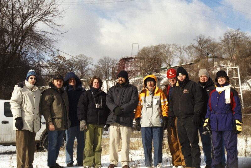
Coke-gas Pipeline assessment group.
After completing a “Phase I” environmental assessment on the pipeline property, ROS became wary of trail ownership and maintenance and asked U.S. Steel to indemnify them, which U.S. Steel refused to do. While supporting development of the GAP, U.S. Steel required another entity to take ownership of the pipeline segment. [15], [16]
When Rivers of Steel in 2004 expressed their unwillingness to accept ownership of the property, the opportunity opened up for ATA and RTC. With the experience, organizational framework and resources of the ATA and RTC behind her, as well as her own tenacity, Boxx could offer Hardy and the SVTC[17], [18] a way forward—in both senses of the word.
“I don’t know if people would have fought so much [to connect the gaps],” Hardy said, “if it weren’t for the bigger connection”[19]—the linking together of regional trails to create what became known as the Great Allegheny Passage.[20],[21],[22]
Good Luck, Hard Work, and Secret Weapons
The trail builders knew they would need the backing of both industry and government agencies to obtain trail alignments. Fortunately, history seemed to be working in their favor.
To celebrate the 250th anniversary of the naming of Pittsburgh, the Allegheny Conference on Community Development (ACCD) created the Pittsburgh 250 Commission[23] in 2005[24] to plan, market, and host regional events throughout 2008 that would highlight southwestern Pennsylvania’s integral roles in the founding and development of the United States.[25]Significantly, completion of then-undetermined “signature projects” were part of the planning. At some point, most likely in 2005, Davitt Woodwell suggested to receptive ears, “How about completing the GAP?” [26], [27]
And so, in what Boxx called “a little bit of a mystery,”[28] the GAP became one of the Commission’s three separate but related “signature projects, collectively pitched as “A Trail Like No Other”: the 1758 Forbes Campaign Driving Trail and the Great Allegheny Passage, both of which would end, symbolically and physically, at a renovated Point State Park fountain.
The ACCD wanted to change how the region was perceived locally, nationally, and internationally. Far from “hell with the lid taken off,”[29] people in Pittsburgh and western Pennsylvania in general not only lived—they thrived. By encouraging trail development, the region’s leaders sought to emphasize Pittsburgh’s renaissance and extend economic possibilities and improved quality of life to former mining and mill towns.[30]
Through these two specific trails, the Pittsburgh 250 celebration would highlight some of the region’s most consequential roles in history, linking the past, present, and future of a former frontier town referred to by historian and Pittsburgh native David McCullough as “the indispensable American city.”
John Surma & Dan Onorato, Riverton Bridge deed transfer.
To give Boxx, Hardy and their team the greatest chance of success, John Surma and Dan Onorato were appointed co-chairs of the Pittsburgh 250’s initiative to complete the GAP.
Onorato, then the Allegheny County Chief Executive, became an important ally for trail builders.[31]
While Boxx referred to PEC President Davitt Woodwell as one of the GAP’s “secret weapons,” Woodwell in turn called John Surma[32], then-CEO of U.S. Steel, who became another GAP “secret weapon.”[33] An avid cyclist [34] and native Pittsburgher, Surma had known the possibility of connecting his hometown with the Nation’s capital ever since one of his earliest rides on the C&O Canal Towpath in the 1980s.[35] As head of one of southwestern Pennsylvania’s largest corporations, he held significant influence with the businesses and infrastructure that were crucial to securing a trail alignment.
So, Boxx helped the ACCD organize a bus tour, held on September 28, 2006, for an on-the-ground look at what needed to be done to eliminate gaps in the GAP; trail builders local industry partners, including Surma,—were able to see just how dramatically the bicycling experience would be shaped by the alignment.[36] [37],[38]
To have the Pittsburgh 250 Commission, including Onorato and Surma, behind the GAP team meant the GAP became the concern of stakeholders who were not solely trail builders. Becoming a Pittsburgh 250 signature project made the quest to fill the gaps in the GAP a regionally significant endeavor.[39]
That’s not to say that the trail builders’ task suddenly became easy; while the GAP’s new status as a signature project of Pittsburgh 250 certainly helped provide invaluable support to Boxx and Hardy, a tremendous amount of hard work was needed to make the trail a reality.
Eager to move ahead with the acquisition of the pipeline property, Hardy and Boxx engaged the combined efforts of the Regional Trail Corporation (RTC) and ATA. Since the pipeline property was no longer needed by U.S. Steel, Surma was more than willing to sell the land to the RTC after proper remediation.[40] By formally joining the RTC, the SVTC allied itself with an established entity willing to take ownership of a property that, for reasons of legal liability, not every organization would be willing to accept. Boxx and the RTC didn’t hesitate to purchase the 1.9-mile corridor.[41] It was decided: U.S. Steel would oversee the environmental cleanup of the property—including removing the pipeline—and hand over a clean piece of land to the RTC for $550,000, which officially happened on December 19, 2006. U.S. Steel real estate agent Joe Curro said “you finally did it after many unsuccessful attempts (by others) at the acquisition.”[42], [43], [44],[45],[46],[47]
The pipeline property was the first piece of the remaining nine miles of real estate that GAP trail builders needed to acquire — their first victory in eliminating gaps in the GAP and without this key acquisition a reasonable alignment would not be possible.
Boxx and Hardy could now set their sights on acquiring lands to create continuous route which, at the time, was not yet clear. Their challenge? The trail builders needed to negotiate with more than a dozen property owners—businesses, corporations and municipalities—to acquire lands for the GAP that would connect with the pipeline property.[48] With the trail so dependent on property owners’ willingness to sell or grant easements for use, one rejection within the relatively short distance between McKeesport and Pittsburgh would prevent completion of GAP. But first, they needed to find someone to manage development of the segments.
Bridging the gaps
By fall 2006, Boxx realized the need for a project manager. At a Regional Trail Corporation board meeting, with a nudge to Boxx who was sitting beside him, Jack Paulik shared a thought: “‘Hey, I’ll help you … I’ll do that job,” Boxx remembers him saying. But Paulik had no idea that none of the properties had been acquired.
Paulik, who had retired from Westmoreland County Bureau of Parks and Recreation the year before, had heard about the pending acquisition of the coke-gas pipeline corridor in the Steel Valley section of the trail.[49] As a park planning coordinator he had 30 years of experience under his belt, as well as some newly-acquired free time. He soon learned the extent of work that had to be done.
“‘I can build a trail almost anywhere because I have a lot of experience,’” he remembers thinking. “But I can’t build a trail until I get something to build it on.”[50]
After less than two years of retirement, Paulik found himself back in his work boots, at the helm of the largest projects of his career—a project that both celebrated and shaped the region’s history.[51]
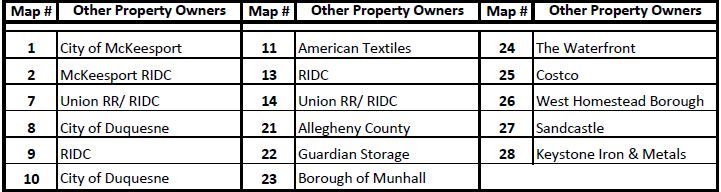
Jack Paulik inspects the RIDC section,2007.
So, he did the only thing he could do: He got to work.
The city had refashioned the Hot Metal Bridge, then owned by the Urban Redevelopment Authority (URA), for bicycle and -pedestrian transit over the Monongahela River between the city’s South Side and Oakland neighborhoods in 2007.[52] Paulik faced a similar but less clear-cut challenge up-river — how to cross the river and connect McKeesport to Duquesne. The McKeesport side[53] of the Monongahela was home to unused industrial property owned by the Regional Industrial Development Corporation (RIDC), while on the Duquesne side[54] sat remnants of a former steel mill also owned by the RIDC. On both sides, active Union, Norfolk Southern, and CSX railroad tracks traced the properties’ edges—an intricate braid of tracks that Woodwell calls “a spaghetti mess.”[55],[56] And, the trail builders also needed to determine how trail users would get across the Mon River.
The high cost of building a bridge prevented the trail builders from considering constructing an entirely new bridge for pedestrians and cyclists. That left them with two possible bridges to use. When Larry Ridenour still worked for Rivers of Steel, he inquired with Union Railroad about the possibility of bike/pedestrian cantilever bridge[57] (“a tag-along” bridge, as Paulik called it)[58] that would attach to the side of the Riverton Bridge, a railroad bridge that at the time was still in use by U.S. Steel subsidiary Union Railroad.[59],[60],[61] The other option was to use the sidewalk of Route 837’s McKeesport-Duquesne Bridge—a less desirable trail alignment that would require several switchbacks on either side of the bridge, which was considerably higher in elevation than the Riverton Bridge.[62],[63]
Boxx, Paulik, and their trail-building team hoped U.S. Steel would allow them to install a hanging “tag-along” bridge on the Riverton Bridge. But U.S. Steel had another idea.
Through the Pittsburgh 250 committee, Boxx had spoken with Tom Sterling, a senior executive at U.S. Steel[64], about the possibility of a hanging bike/pedestrian bridge.[65],[66] When Sterling took the bridge conversation to Surma, the question became: What is the bridge used for, anyway? In fact, very little.
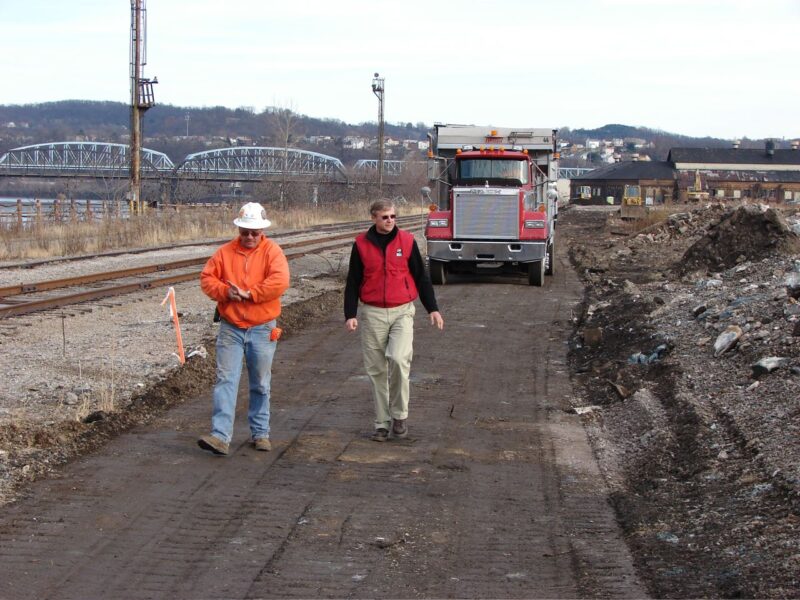
One of the last trains over Riverton Bridge.
One train crossed the Riverton Bridge every week. And when they did the math, they could just as easily—and potentially more efficiently— use ground transportation to carry steel from one side of the river to the other. Although monumental for the trail, the Riverton Bridge carried little weight for U.S. Steel’s operation. As Surma explains, “It was best to convey the bridge to the community and complete that trail so that it would be something that …everybody else would enjoy.”[67]
And so early one morning, while Boxx was on one of her many (most likely trail-related) car drives around western Pennsylvania, she got a cell phone call from Sterling. She recalls that she answered the phone, listened to what Sterling had to say, and went quiet, thinking, “Did I hear him correctly?”
Sterling: “Did you hear what I said?” she remembers him saying. “We’re going to give you the Riverton Bridge.”[68]
Boxx, Hardy and Paulik couldn’t have been more pleased. They were so excited, Paulik says, that “we kind of felt like we were just going to jump off the bridge because we’re getting the Riverton Bridge for a bike trail.”[69]
U.S. Steel agreed to sell the bridge, still structurally sound at 110-plus years old, for $1 if Allegheny County would assume ownership and liability.[70] The County, with the support of Onorato, would have to accept ownership of the bridge on behalf of the trail builders.[71]
Despite the generous offer, the County was reluctant to accept responsibility for a bridge they knew nothing about. Was it indeed structurally sound? When was the last inspection? What kind of regulations must be met? For the County to assume ownership, the trail builders were told, a detailed study had to be completed—a process that would take months and cost about $250,000.[72] Meanwhile, Paulik, with a deadline for the Pittsburgh 250 celebrations a few months away, needed to start work on decking the bridge and building a ramp on the McKeesport side.[73]
The sale was at a standstill. However, after considerable back and forth over a period of months, before losing the bridge as one of the vital links in the GAP,
Riverton Bridge ramp construction.
Kathy McKenzie, Oronato’s Chief of Staff at the time [74] [75] and another ‘secret weapon,’ pushed the transaction through the County bureaucracy.[76] [77] [78]
Once County accepted ownership of the bridge, Paulik had a mere 60 days to turn the railroad bridge into a walking and biking facility that could be used during the Pittsburgh 250 PNC Legacy Relay Ride.[79],[80],[81],[82]
Fortunately, 60 days was enough. Boxx had previously given Paulik the go-ahead to start building the half-million dollar ramp up to the bridge–a leap of faith since U.S. Steel still owned and operated a railroad on it. The ramp was nearly completed by the time the County took ownership of the bridge. Within the 60 days, they demolished the unneeded railroad ramp and re-decked the bridge for bicycling and walking.[83],[84]
On September 25, 2008, a beautiful fall day, the Riverton Bridge was dedicated. One week later,[85]as the contractor installed the last fencing, bicyclists crossed the bridge as part of the Pittsburgh 250 PNC Legacy Relay Ride.[86] For the first time in its long history, the bridge became a symbol of the people, connecting the region’s industrial past with a transformative future.[87]
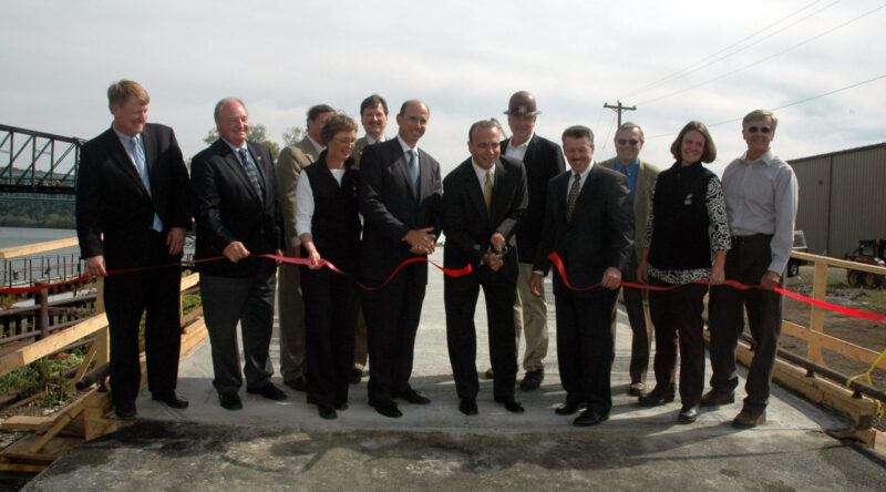
Riverton Bridge ribbon cutting.
With the Riverton Bridge completed, the trail builders could turn their attention to another pressing concern: connecting the Coke Gas Pipeline section to the rest of the GAP.
You Have Two Hours, Boys!
Boxx and company knew that closing the gaps in the GAP would require more than just trail builders seeing eye-to-eye. The “Signature” bus tour in 2006 had helped to illuminate the path forward.[88]
Paulik remembers the tour well. He and his fellow trail builders made a point of showing government and industry leaders the most desirable trail alignment along the railroad tracks in Duquesne. “We knew,” he says, “this was the best alignment we didn’t have.” The most important potential allies saw with their own eyes what needed to be done. “They said, ‘You have to stay on the river and you have to build bridges and cross the railroads back and forth and stay down here.’” Paulik recalls. “And we [the trail builders] knew this all along, but now we were getting support from them.”
Crossing the railroad tracks required aerial easements from the owner, Norfolk Southern Railway. Addressing requirements of the Railway and navigating topography and existing infrastructure required considerable care.[89] “It took at least two years to acquire these easements,…develop bridge contracts,[90] and get to the point where, eventually, a date was established to put the bridges up,” remembers Paulik, who was determined to make gradual yet consistent progress.[91]
With Surma’s invaluable assistance, the trail builders were able work with Union Railroad and Norfolk Southern, who owned the majority of the tracks that the alignment would need to navigate. Since U.S. Steel made up one third of Norfolk Southern’s business on those tracks, Surma’s support was pivotal.[92]
Because the bridges would be spanning active railroad tracks, the flyover bridges could not be built from the ground up and would need to be prefabricated and set in place using cranes. [93] “These two flyover bridges and ramps…were in 28 tractor trailer loads of parts that we needed put together,” Paulik recalls. “So, we had to organize this in a systematic manner…it was like an erector set. [Each truckload] had to [arrive] at the right time.”[94] To do this, the trail builders needed to accomplish the nearly impossible: halt all railroad traffic so cranes could access the tracks to set the bridges in place.
With many moving parts, meticulously organized plans were essential. “Every time we would meet with [the contractors], action to meet all the goals to meet our objectives,” Paulik explains. “We had to have all the concrete done in a certain time, the pile driving, the delivery of all the products.”

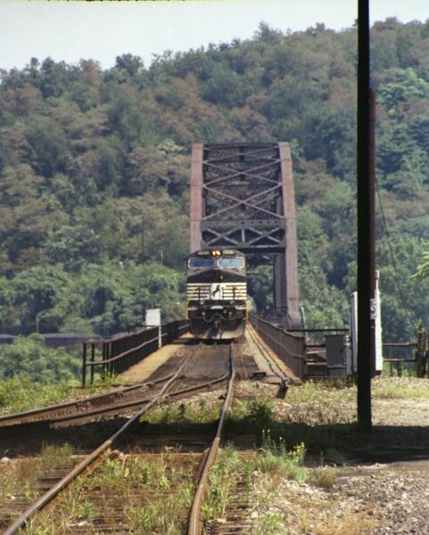
Delivery of the Port Perry prefab bridge.
“Those tractor trailer loads [with the pieces of the ramps & flyover bridges] would come anytime in the day or night.”
They might arrive on a Friday night at 7:00 or 4:00 in the morning.”[95] Regardless, someone had to manage the assembly. Their goal: put the bridges in place on July 7th, 2010, during what the railroad operators called Hell Week[96]–the period of time around the Fourth of July during which the railroads almost completely halt rail traffic to do track maintenance.
But getting permission to cover five tracks with gravel, put timber mats on top of the gravel, and bring cranes onto the mats was a tall order. “It took a lot of negotiation to get track time to put these bridges up,” Paulik says. “And, eventually, they said, ‘We’re going to give you two hours. We’re going to shut our track down for two hours to put them up simultaneously.’”[97]
After years of preparation, planning and hope, the trail builders were ready to connect the coke-gas pipeline section to the alignment in Duquesne.
Hell Week
Without the success on July 7, 2010, that the most challenging gaps may not have been eliminated.
“You know, the trail would have limped into Pittsburgh,” Boxx remembers saying. “It could have been really awful: …sidewalks, and hills, and traffic signals.” With the coke-gas pipeline section as the linchpin, the trail builders hoped to give bicyclists and walkers a dramatic experience through the twists and turns of the land that helped build America. In a region home to approximately 2,000 bridges,[98] they only need to add two more.
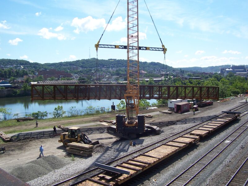
Early that July morning, the sun enshrined in fog[99], two 500-ton cranes were simultaneously moved into place[100]—one at Port Perry and the other in Whitaker—where they lifted pre-assembled 130-foot and 170-foot-long bridges over the freight-less tracks to their final resting places—all within a window of two hours.[101]
“This [was] the main line of Norfolk Southern,” Boxx emphasizes. “This [was] big.”
If the bridges were less than 23 feet above the railroad tracks[102] or the bolts were more than two to three inches off,[103] the bridges could not be set in place. “‘There’s not a do-over on this’,” Paulik remembers saying:[104]
“If it all worked, I’m kind of a hero and having fun,” Paulik says. “But if there was one glitch, the whole thing would go south. And, not to put any more pressure on that, but that evening they had a scheduled event to celebrate this and it hadn’t happened yet.”[105]
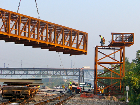
Crane lifting the Whitaker Bridge.
Donned in hard hats, Paulik and Boxx waited at the Whitaker site.[106] Dozens of spectators observed from a pedestrian bridge farther down the tracks. With the cranes in place, the two crane operators picked up and swung the bridges across the tracks and into place.
Boxx, Paulik and others waited anxiously while railroad engineers measured the distance between the bridges and the tracks as the cranes held the bridges overhead.[107]
All of their hard work had paid off: Within an hour, the last two bridges needed for the Great Allegheny Passage were in place which would help connect the Nation’s capital with the City of Bridges.[108] [109]
Lifting Whitaker Bridge to ‘bridge’ the Great Allegheny Passage.
Beyond the pipeline section and the two bridges, however–before reaching the city limits–the path to complete the GAP was unclear.
Difficult People & Excellent Partners
While the GAP was not completed before the aspirational deadline of October 2008 for the Pittsburgh 250 celebration, successful acquisitions in McKeesport, Duquesne, and West Mifflin enabled trail builders to maintain momentum. Determination continued to be tested, however, during efforts to complete the last remaining stretch—the three miles along the Monongahela between Munhall and Baldwin.
When the Waterfront shopping center was being developed along the River through Munhall, Homestead, and West Homestead, planners included a walking and bicycling trail, a feature the municipalities were not required to accept. Munhall and Homestead were open to the idea of working with trail builders, perhaps recognizing the potential economic advantages of a multi-use facility bringing customers to the many businesses.
However, on the western end of the Waterfront, in the municipality of West Homestead, local officials balked at the notion of a trail. According to Darla Cravotta,[110] they wanted to retain municipal access to the River without worrying about trail users.[111] Eventually officials allowed variances for a widened sidewalk in front of Costco–not the trail builders’ ideal design. At the County level, Cravotta’s attempts to permit development of a trail behind the Waterfront businesses along the River were unsuccessful and the idea vehemently rejected.[112] Although the alignment within the Waterfront development was not ideal, the sections eliminated a few remaining gaps in the GAP.
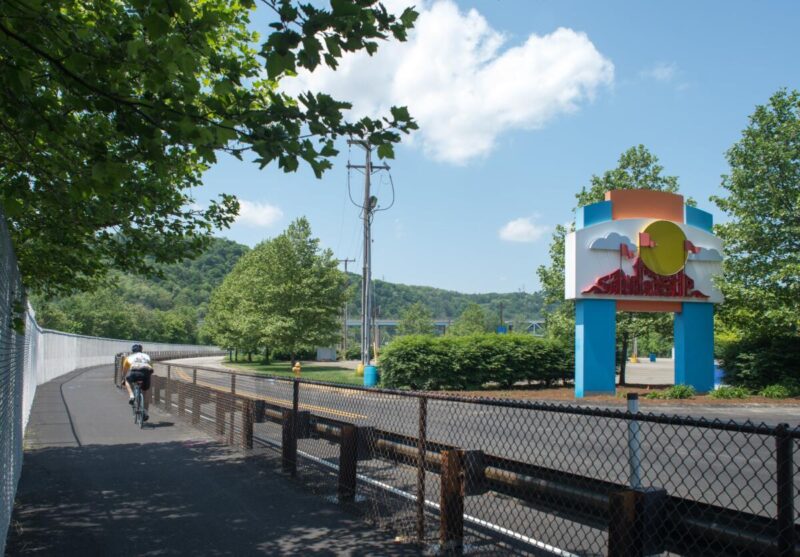
Farther downriver, near the southern end of the Glenwood Bridge, the Keystone Iron and Metal Company, Inc., section was in trail-building limbo—and had been since the 1990s when they first agreed to work with trail builders and provide property for the trail.[113] Despite their willingness, no work could be done on the section, classified as a “brownfield,” without agreement on an alignment within the adjacent Sandcastle Waterpark property .[114] In Hardy’s words, it was one of two “companion projects” that, due to their proximity, needed to happen in tandem.[115] And so, a mere .85-mile section of land in Sandcastle proved to be the most challenging acquisition.
What once was used as a railroad yard[116] had been turned into Sandcastle Waterpark, owned since its 1989 founding by Kennywood Entertainment.[117] Although the challenge to extend the trail from Baldwin through Sandcastle became public knowledge in 2006, trail builders’ discussions with Sandcastle went as far back as the mayoral term of Sophie Masloff, when Kennywood owner Harry Henninger offered the city a piece of Sandcastle’s property, which the city declined.[118]
By 1993, when mayor-elect Tom Murphy sought to extend the trail through Sandcastle and along the Monongahela River, Henniger had, for unknown reasons,[119] adamantly changed his mind about selling property to the city, essentially stalling trail building efforts there.[120],[121] “There was a long time where I didn’t think the Sandcastle connection was going to happen,” Hardy remembers. At that time, she says, as long as the significant gaps between Baldwin and McKeesport remained, particularly the corridor that included the coke-gas pipeline, a trail through Sandcastle was not going to happen.[122]
A turning point came in 2007, when Kennywood Entertainment announced that Parques Reunidos, a Spanish company, was purchasing Kennywood Entertainment, acquiring both Kennywood and Sandcastle. New ownership presented a new opportunity for Oronato at the County to help get the GAP through Sandcastle. Parques Reunidos, however, wanted the trail to be physically separated from the waterpark, preventing access between the two.[123],[124]
Complicating matters was the discovery that a small slice of the road leading to Sandcastle was owned by railroad company CSX, necessitating an additional easement—with all of the requirements an easement entails—so that the trail footprint could be a sliver of the road. At this point, Cravotta remembers thinking:
“Oh, my God. It has been 20 years since we started talking about this. And it’s .85 mile. How can something so small stop a 150-mile project?!”[125],[126]
Sandcastle-Keystone Metals completed in 2013.
In October 2010, the trail builders finally breathed a sigh of relief: Allegheny County Executive Dan Onorato and Sandcastle General Manager Damian Dondero signed a ceremonial easement agreement at Sandcastle.[127]
The Great Wall
In 2012, work on the final stretch of trail began and included a key acquisition from Keystone Iron and Metals. The final project ended up costing several million dollars less than earlier estimates and gave trail users a considerable buffer from active railroad tracks—[128],[129],[130] thanks, in part, to Paulik’s make-it-happen work ethic.[131]
The original plan was to locate the trail alongside the active railroad. Paulik proposed moving the trail up to level of Keystone’s property—a move that required more land but Paulik knew this would save money on construction and maintenance in the long-run.[132] Denny Thompson, owner of Keystone Iron and Metals, was willing to see what Paulik had in mind. A nearby contractor cleared space for the trail; trees were cut down and the ground leveled.[133] After two weeks of work, Paulik showed Thompson the proposed alignment: a flat, but crooked, line.[134]
Thompson looked at the site. “Why not make it a straight line?” he offered. And so, with a few additional feet added to the width, the trail was set.[135] And instead of the 30-plus foot wall that would have been required if the trail were at the bottom of the slope (separating the trail from active railroad tracks), Paulik was able to put a 1,200-foot-long, 12 feet high wall and trail users were safely elevated from the railroad to separate the trail from the Keystone Iron and Metal property.[136]
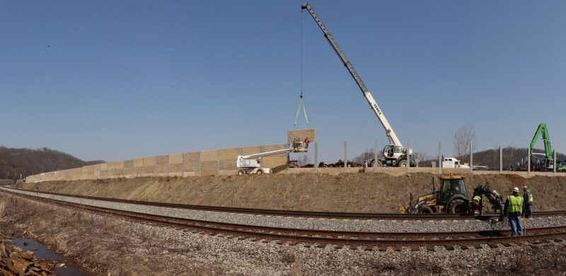
Keystone Metals – The Great Wall.
At long last, in 2013, the gaps in the GAP were gone. The nine miles of trail cost $11.9 million, about the same amount as the 3,300-foot Big Savage Tunnel project.
Point Made! Celebration
On the morning of June 15, 2013[137], the sun-soaked sky greeted hundreds, possibly thousands, of hikers, bicyclists, and revelers as they gathered near Sandcastle Waterpark to kick-off a day- long celebration to recognize completion of the Great Allegheny Passage.
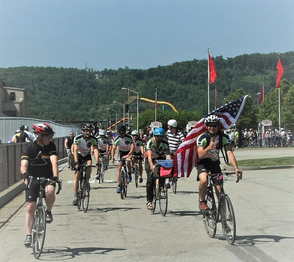
Point Made! ride to the GAP’s Western Terminus 6-15-2013
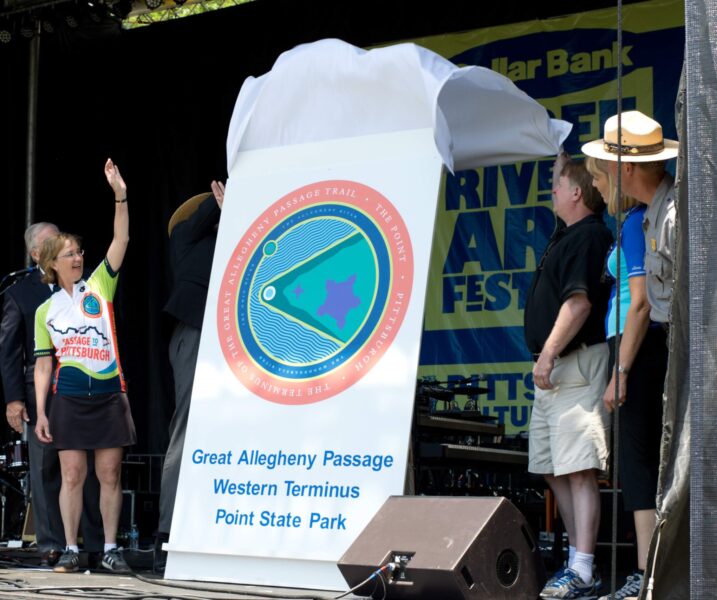
Point Made! the big reveal at Point State Park.
The crowd included early trail advocates and trail builders—including former Mayor Tom Murphy and Boxx —as well as people young and old with a new appreciation for recreational trails.
A victory celebration was held, followed by a parade of bicyclists who made their way, for the first time, to the Western Terminus of the GAP at the confluence of the Monongahela, Allegheny, and Ohio Rivers in Point State Park.[138]
After many decades, through the ambitious determination of a dedicated team of trail builders, the day had come that “will change people’s lives,” Murphy said.[139] [140] All they had to do was get their bicycles or hiking shoes and make the trail theirs.
Author: Susan Wiedel
Endnotes
[1] From Clairton Coke Works to Homestead Works, where it was used as fuel for steel production.
[2] The Allegheny Trail Alliance was incorporated in 1996.
[3] First interview with Linda McKenna Boxx, page 63; fill in number of landowners to deal with and parcels of land.
[4] The Pennsylvania Environmental Council is a statewide nonprofit that assists Pennsylvania municipalities in shaping environmentally sound public policies and also provides assistance to organizations such as the ATA/RTC on specific projects that realize these policies.
[5] Hannah Hardy interview page 8
[6] First interview with Linda McKenna Boxx, page 60
[7] Second interview with Linda McKenna Boxx; waiting on transcription for page number.
[8] Union Railroad was a part of Transtar, which has been owned by U.S. Steel since 1988: https://www.ussteel.com/locations/transtar
[9] for whom U.S. Steel was their biggest single customer, shipping what? verify
[10] Rivers of Steel Heritage Corporation, previously known as the Steel Industry Heritage Corporation: https://riversofsteel.com/about/; https://steelvalleytrail.org/about-us/
[11] Summarize: Rivers of Steel out of same moment as Murphy in wanting to reinvigorate former industrial sites for public use, but they weren’t quite up to the gaps in the GAP, when SVTC joined more with RTC.
[12] Officially incorporated in 2000 as the Steel Heritage Trail Council within the heritage organization, Rivers of Steel, which was previously known as the Steel Industry Heritage Corporation: https://steelvalleytrail.org/about-us/
[13] Hannah Hardy interview page 6
[14] The coke-gas pipeline was in their sights after they completion of the Trail Alignment Study that SIHC commissioned 1996 to identify possible trail alignments that would connect McKeesport to Pittsburgh, as well as a connection to Clairton: https://steelvalleytrail.org/about-us/
[15] Meanwhile, it was important for U.S. Steel to hand the property over to a larger, established organization like the Regional Trail Corporation for liability reasons. (Hardy interview pages 14-15)
[16] This was also partially because of the difficulties posed by state funding requirements and the strict environmental cleanup requirements. (Hardy’s interview pages 14, 19-20)
[17] At this point, Hardy has left the mayor’s office and transitioned to the Pennsylvania Environmental Council, where she worked under Davitt Woodwell. At the PEC, Hardy’s work with the SVTC became part of her job.
[18] Hardy joined Boxx on the ATA and RTC boards when?
[19] Hannah Hardy interview page 8
[20] First interview with Linda McKenna Boxx, pages 60-63
[21] Mention Mayor Sophie Masloff and her work on trails prior to Murphy taking office
[22] One pages 62 and 63 of the first interview with Boxx, she mentions how the bigger vision for the GAP wasn’t considered until the 1990s because the railroad tracks that would be used for the future trail throughout part of southwestern Pennsylvania (specifically the P&LE) had not yet been abandoned. Once the P&LE Railroad had abandoned its tracks, the trail could follow those tracks from Connellsville to McKeesport.
[23] Jim Rohr, then-CEO and chairman of PNC Bank, was the chair of the ACCD’s Pittsburgh 250 Commission as well as the 2006-2008 chair of the ACCD: https://www.alleghenyconference.org/wp-content/uploads/2016/08/AnnualReport08.pdf
[24] page 15: https://www.alleghenyconference.org/wp-content/uploads/2016/08/AnnualReport05.pdf
[25] The Pittsburgh 250 emerged while the French and Indian War 250, the 250th commemoration of “the war that shaped America”/ “the world’s first world war,” was well underway across several states.
[26] There are several possible explanations for who suggested the GAP and how it was chosen as one of the signature projects. Perhaps it was something Davitt Woodwell, longtime employee (at the time executive vice president) of the Pennsylvania Environmental Council, said during one of the ACCD meetings; Boxx also had several connections to the ACCD. And then there was PNC’s Jim Rohr, chair of the Pittsburgh 250 Commission: As Boxx suggested on page 17 of interview with Woodwell, completing the GAP as a signature project would have dovetailed with PNC’s recent purchase of Washington, D.C.’s Riggs Bank. Formerly known as “the Bank of Presidents,” Riggs Banks was headquartered in D.C.’s Georgetown neighborhood, where the C&O Canal Towpath Trail (which connected with the GAP trail) ended. On page 25 Hardy also mentioned Rohr’s role in bringing together the county and local industries to the table for the Pittsburgh 250. But according to an article in the Pittsburgh Quarterly: “The Signature Projects Committee of Pittsburgh 250, chaired by Mike Watson of the Richard King Mellon Foundation, and C.J. Queenan, Jr., of K&L Gates, recommended that the commission adopt the [Great Allegheny] passage as a priority.”
[27] “A Grand Idea: Pittsburgh 250” by Bill Flanagan in the Fall 2008 issue of Pittsburgh Quarterly: https://pittsburghquarterly.com/articles/a-grand-idea-pittsburgh-250/
[28] Page 14 of interview with Davitt Woodwell.
[29] https://www.theatlantic.com/magazine/archive/1868/01/pittsburg/536130/
[30] In the interview with John Surma, Surma mentions that Chuck Queenan was integral to the historical lens of the Pittsburgh 250 on page 29.
[31] County government would have to be willing to accept ownership of some trail properties, and would also have to provide oversight for planning and implementing the trail design.
[32] https://www.alleghenyconference.org/wp-content/uploads/2016/08/NewLeadership031809.pdf
[33] In his interview, Woodwell mentions that his wife, who has held various positions as legal counsel at U.S. Steel, potentially played a hand in persuading Surma to be a proponent of the GAP. page 21
[34] See Pittsburgh Post-Gazette article “Bridge over Mon fills bike trail’s missing link” by Lawrence Walsh from 9/26/08, in which there is mention of Surma and his wife biking the C&O in the 1980s, when they came across a man who said, “Someday, they say it’ll go all the way to Pittsburgh.”
[35] See footnote 41
[36] Jack Paulik interview pages 12-13
[37] Paulik interview pages 12-13
[38] Hardy Interview pages 22-23
[39] Hardy interview pages 23-24
[40] John Surma interview pages 2-3
[41] Linda McKenna Boxx first interview, page 60
[42] The property would be owned by the RTC.
[43] Agreement to transfer the land in late 2006; transfer official in April 2007: https://www.gaptrail.org/system/resources/W1siZiIsIjIwMTcvMDIvMTYvMTcvMzcvMjUvMzg2L1RyYWlsTmV3c19WN18yX1N1bW1lcl8yMDA3LnBkZiJdXQ/TrailNews%20V7%2C2%20Summer%202007.pdf
[44] Price paid by RTC for Coke Gas Pipeline; Pennsylvania’s Department of Conservation and Natural Resources (DCNR) contributed $200,000 for the purchase of the pipeline property: https://gaptrail.org/system/resources/W1siZiIsIjIwMTgvMDkvMDcvMTcvNDgvNTQvNjM4L1ZvbF81LjVfU3VtbWVyXzIwMDUucGRmIl1d/Vol%205.5%20-%20Summer%202005.pdf
[45] John Surma interview pages 6-7
[46] Joe Curro, the real estate representative working for U.S. Steel, applauded the ATA’s determination. Woodwell: “Joe Curro is a hero in this.” Boxx concurs: “A different real estate agent wouldn’t have been this patient [to wait for the trail-builders to go through all of the required channels to purchase the coke-gas pipeline.” This was in large part due to the nature of purchasing and funding the trail work: On pages 17-18 of Hardy’s interview, she discusses how getting the coke-gas pipeline property appraised posed challenges simply because of the lack of comparable properties. Once an appraisal was determined, any land purchased with public grant money required proof that it was an environmentally clean site. Many grants also required matching funds.
[47] There was also precedent with U.S. Steel selling land it no longer used for nonprofit/historic use. See pages 5-7 of interview with John Surma, in which he discusses land U.S. Steel had recently sold in Alabama.
[48] There are a variety of reasons for the potential difficulties of working with property owners to gain access to land. One reason, as Hardy mentions on page 5 of her interview, was that property owners thought public-access trails would invite more crime and delinquency to their neighborhoods and properties. (In reality, anecdotal evidence has shown the opposite to be true: increased traffic by recreational trail users helps discourage criminal activity.) Another factor may have been the widespread anti-environmental, anti-regulation attitudes at the center of the private property rights movement that peaked in the 1990s. The nationwide movement (with a strong presence in Pennsylvania) was championed by municipalities and private property owners who didn’t want county, state, or federal government to tell them what they could and could not do with their land: https://www.latimes.com/archives/la-xpm-1992-10-04-re-762-story.html; see pages 9-12 of interview with Davitt Woodwell for additional context regarding anti-regulatory attitudes and PEC’s work.
[49] On page 2 of the interview with Paulik, he mentioned that he attended RTC meetings in the year prior to committing to filling the gaps in the GAP project solely as an observer and to provide feedback.
[50] Page 2 of interview with Jack Paulik
[51] Paulik officially came on board as a paid construction coordinator by the end of 2006.
[52] Work on the Hot Metal Bridge began in 2006; the bridge opened to the public in November 2007, connecting the Eliza Furnace Trail to trails along the southern bank of the Monongahela River.
[53] According to Paulik on page 24 of his interview, the trail through McKeesport was not completed until 2013.
[54] Paulik describes the Duquesne-side of the river on pages 25-30 of his interview.
[55] Davitt Woodwell interview page 32
[56] Trail-builders put in what Paulik called “an inordinate amount of work” to turn the RIDC properties into quality trail—negotiating, zoning, planning, and development. This included working with Union Railroad, which agreed to remove some track so that the trail wouldn’t need to cross them. See pages 14-17 of interview with Paulik.
[57] Hardy interview pages 20-12
[58] Paulik interview, page 6
[59] Hardy interview pages 18-21
[60] Paulik interview page 6: “It was very expensive and the railroad didn’t like that idea because it had liability issues.”
[61]Surma describes how the Riverton Bridge was used on page 17.
[62] Paulik interview pages 6-7: “kind of a wild idea, but options [were] limited and very, very expensive.”
[63] Surma interview page 20, Paulik mentions the height of the McKeesport-Duquesne Bridge (50 feet higher than the Riverton Bridge) being a problem.
[64] Sterling was the former president of Transtar, which owned Union Railroad.
[65] Pages 19-20 of interview with John Surma
[66] U.S. Steel also didn’t like the idea of the hanging bridge for multiple reasons; description on page 21 of interview with Surma.
[67] Surma interview page 18
[68] Page 20 of John Surma interview
[69] Paulik pages 17-18
[70] Paulik interview pages 17-20
[71] Darla Cravotta interview page 13
[72] Paulik interview pages 20-22
[73] The ramp on the McKeesport side of the bridge was built before the sale of the bridge was finalized. Page 15 of Boxx’s second interview.
[74] Boxx second interview, pages 15-16
[75] John Surma interview page 15
[76] Paulik interview page 20
[77] Surma interview page 15
[78] In lieu of a $300,000 inspection plus repainting (which would cost $3.5 million), the county agreed to accept the bridge only after receiving all past inspections of the bridge from U.S. Steel as well as a report, signed off on by Bob Luffy of American Bridge. The report basically stated that the bridge stands safely on its own. Paulik explained that the bridge did not need to be painted, despite initial requirements from PennDOT. “The discussion was,” he remembered, “‘This bridge is really strong and solid. You don’t need to paint this bridge and the inspection is good.’
Because once you sandblast it, you’re exposing the components to rusting that you maybe don’t want. (Pages 18-21 interview with Paulik)
[79] Paulik interview pages 22-23
[80] Surma interview page 30
[81] In the first interview with Boxx, on pages 66-67, Boxx said that the ATA/RTC received $1 million from COLCOM and $1 million matching funds from the state to revamp the Riverton Bridge for bike/pedestrian use. Also on page 36 of the interview with John Surma.
[82] On page 22 of Paulik interview, he says they completed the Riverton Bridge portion with a little more than $2 million. Also on page 36 of the interview with John Surma.
[83] Paulik interview pages 22-23
[84] Paulik discusses costs in his interview on page 23. With all of the excess steel that was the byproduct of demolition, the trail-builders ended up regaining $80,000 of the $2 million they spent upgrading the bridge.
[85] Pittsburgh 250 ride Oct. 4-5, 2008
[86] Fall/Winter 2008 ATA newsletter:
[87] The trail from the Riverton Bridge into Duquesne was not completed until the following year: http://phcapgh.org/category/allegheny-county/page/8/
[88] See page 5 of article, where Funders’ Tour is first introduced.
[89] Paulik interview pages 31-35
[90] Contech won the bid to construct the bridges. The parts
[91] Paulik interview page 31
[92] http://phcapgh.org/category/allegheny-county/page/8/
[93] Paulik interview pages 35-38
[94] Paulik interview page 38
[95] Paulik interview page 46
[96] Paulik interview page 38
[97] Paulik interview page 39
[99] page 23 of second Boxx interview
[100] Paulik page 41
[101] Second Boxx interview page 23
[102] The railroad engineer required 23-foot clearance between tracks and bottom of bridges. Paulik page 41
[103] Paulik page 40
[104] Paulik page 40
[105] Paulik page 42
[106] Second Boxx interview page 22
[107] Paulik page 41
[108] https://www.heinzhistorycenter.org/blog/western-pennsylvania-history/pittsburgh-the-city-of-bridges
[109]https://www.post-gazette.com/life/lifestyle/2013/06/13/Let-s-Learn-From-the-Past-City-of-Bridges-1/stories/201306130369
[110] Darla Cravotta interview page 11
[111] Second interview with Boxx, pages 30-31
[112] On page 11 of Cravotta’s interview, she mentions her confusion regarding West Homestead’s opposition of the trail.
[113] On Hardy pages 30-31, she mentions that the original alignment with Keystone Metals, which was agreed upon in the 1990s, changed after the agreements with Sandcastle and CSX were finally settled.
[114] This was due, in large part, to varying safety requirements for different parts of the property, including a possible separation wall that require significant funds.
[115] Hardy interview page 30
[116] https://www.sandcastlewaterpark.com/plan-a-visit/about-sandcastle
[117] https://www.post-gazette.com/business/businessnews/2007/12/12/Kennywood-sold-to-Spanish-company/stories/200712120157
[118] Cravotta interview page 10
[119] Hardy mentions confusion over Sandcastle ownership’s aversion to the trail on page 31 of her interview.
[120] Darla Cravotta interview page 2
[121] In Boxx’s second interview on page 37, she mentions that Sandcastle’s president, Pete McKinney (sp?), missed the meeting because he had to choose between that meeting and a root canal, and he chose the root canal. Cravotta also mentions this on page 11 of her interview.
[122] The momentum to build the trail did not yet exist.
[123] Cravotta explains that this was for liability reasons on page 12 of her interview.
[124] Boxx confirms the liability issues relating to the Sandcastle property on page 32 of her second interview.
[125] Cravotta interview page 12
[126] On page 37 of her second interview, Boxx also states that this portion of the trail had been under consideration for 20 years.
[127] https://archive.triblive.com/news/work-begins-on-final-connection-for-great-allegheny-passage/
[128] https://archive.triblive.com/news/work-begins-on-final-connection-for-great-allegheny-passage/
[129] Second interview with Boxx on pages 40-42, she talks about the cost of building the trail on the Keystone and Caruso properties.
[130] Paulik interview pages 51-56 goes in depth on the easement negotiations with Keystone and Caruso.
[131] Paulik interview page 59
[132] Paulik interview pages 56-57
[133] Paulik interview pages 56-57
[134] Paulik interview page 57
[135] Paulik interview page 57
[136] Paulik interview pages 55-56, 58
[137] https://bikepgh.org/2013/05/23/june-bike-events/
[138] http://explore.imaginepittsburgh.com/now/date/2013/06/
[139] https://www.post-gazette.com/local/region/2013/06/16/Bicyclists-celebrate-reaching-end-of-Great-Allegheny-Passage-trail/stories/201306160169
[140] https://pittsburgh.cbslocal.com/2013/06/15/final-link-of-great-allegheny-passage-officially-opens/